
Hier findest du eine Auswahl unserer neuesten Tipps und Tricks sowie Schulungsvideos und kostenlose Projektdateien zum Ausprobieren.
Jedes Projekt enthält ein eigenes Video, das dich Schritt für Schritt durch die Erstellung in der Software führt.
Also, leg gleich los und probier eines der Projekte selbst aus! Teile deine Ergebnisse im Vectric-Forum!
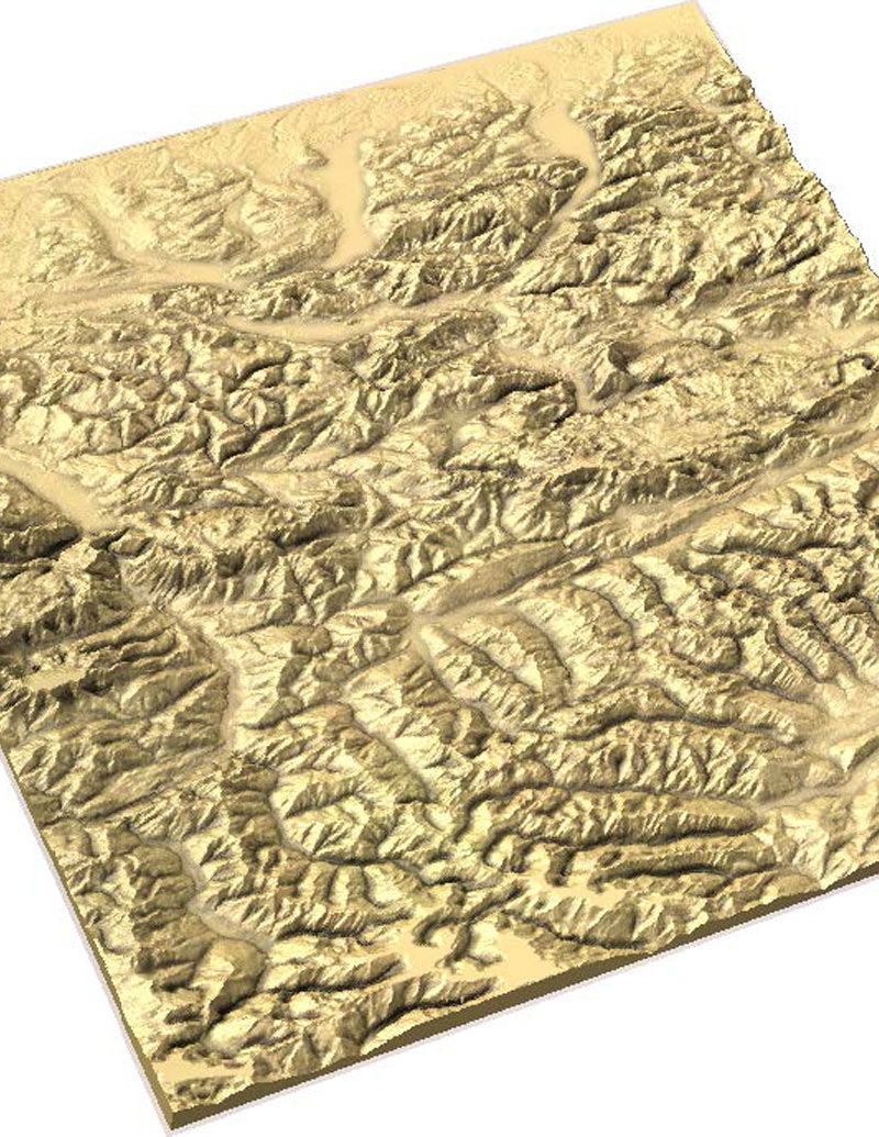
Dieses Jahr fand unser Anwendertreffen in Chicago statt. Technischer Leiter Edward Powell präsentierte, wie man mithilfe von Satellitenbildern Geländekarten erstellt. Im untenstehenden Video oder in der Präsentation erfahren Sie mehr.
Passend für Ausführung 9.5 oder größer
Login to V&Co to download the files
AnmeldungPlease access this page on a desktop computer to download the files
Vectric Ltd
Precision House
2 Arden Road
Alcester
B49 6HN
Eingetragen in England unter der Nummer 05382596
Umsatzsteuer-Identifikationsnummer GB115123072
Datenschutzerklärung |
Cookie-Richtlinie |
Allgemeine Geschäftsbedingungen


