
Aquí encontrarás una selección de nuestros últimos consejos, trucos y vídeos de formación, junto con los archivos de proyecto gratuitos para que los pruebes.
Cada proyecto incluye su propio vídeo que te guía paso a paso en su creación dentro del software.
¡Anímate y prueba uno de los proyectos y comparte tu creación en el Foro de Vectric!
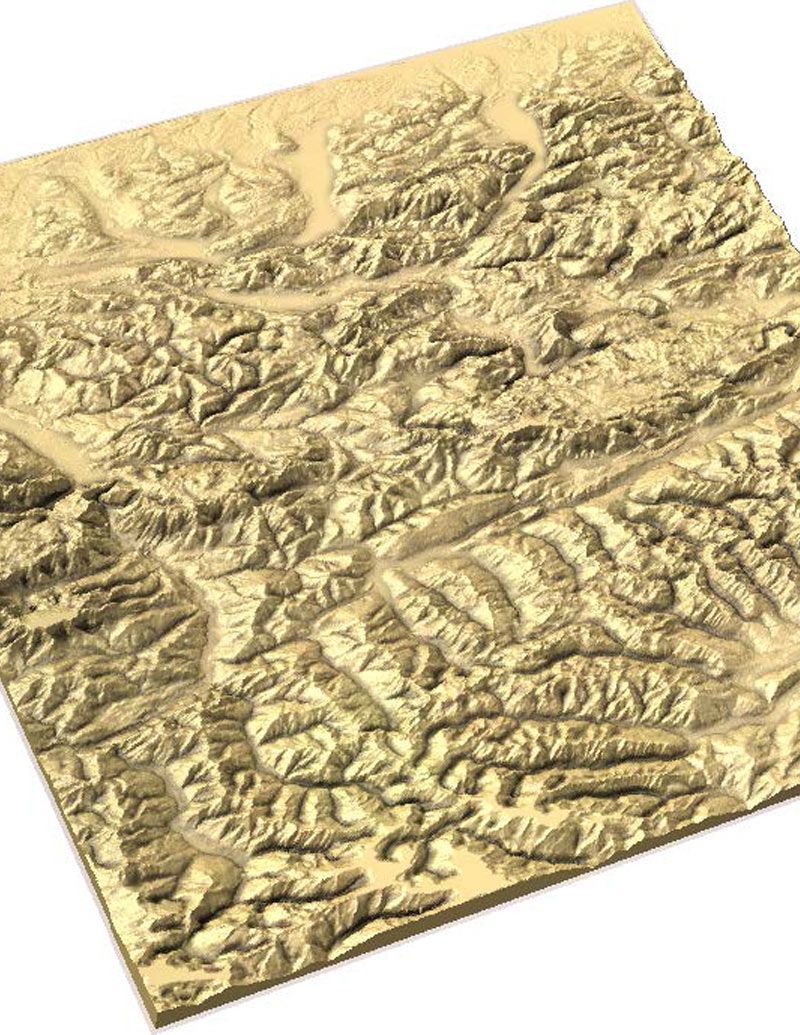
Este año celebramos nuestra reunión de usuarios en Chicago. El director técnico, Edward Powell, presentó cómo crear mapas de terreno utilizando datos de imágenes satelitales. Vea el video a continuación o descargue la presentación para obtener más información.
Adecuado para la versión 9.5 o mayor
Login to V&Co to download the files
Iniciar sesiónPlease access this page on a desktop computer to download the files
Vectric Ltd
Precision House
2 Arden Road
Alcester
B49 6HN
Registrado en Inglaterra Número 05382596
Número de IVA GB115123072
Política de privacidad |
Política de cookies |
Términos y condiciones


